$25.00Original price was: $25.00.$10.00Current price is: $10.00.
Formats : 72 and 300 DPI JPG; Vector editable formats AI, EPS and Layered PDF.
Major Layers in Vector Map : Seaport Type, Sea-and-Ocean, Sea Routes, Coastline, Lakes, Major Rivers, Water, Background, Islands Type, International Boundary, Disputed Boundary, Country Name, Population Data multiple Layer Ranging from 100K to Above 1M, Legend, Airport, Major River Type, Major Lake Type, Province Capital Type, Country Capital Type, Islands Type, Country Capital, Province Capital, Grids
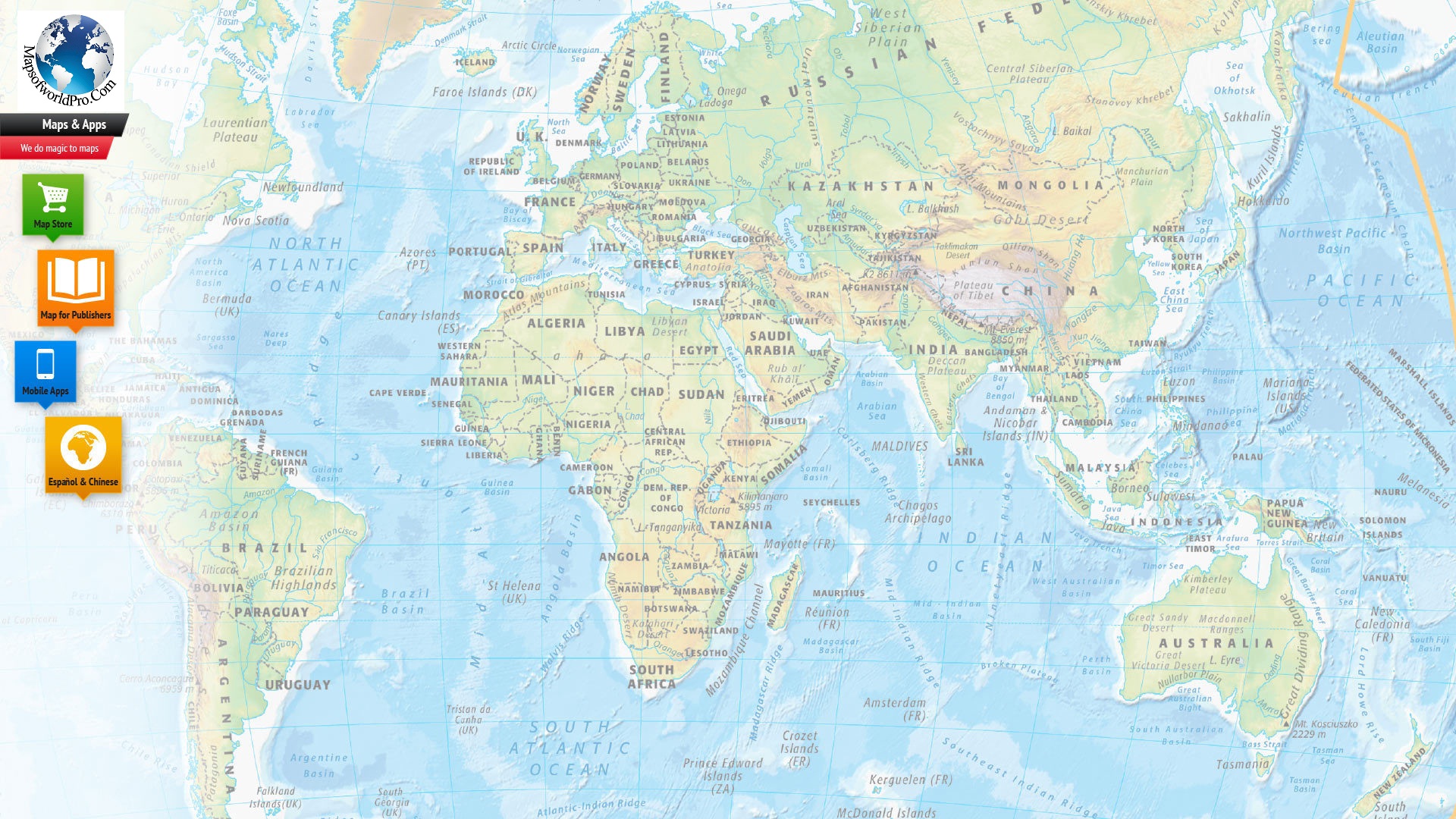
This large World Sea Route Map, with a dimension of 72 by 42 inches, shows the world’s major sea networks with nautical miles.
This detailed colorful map provides additional information about the distribution of the world countries, international borders, and location of capital and major cities, seaports, and airports.
Depiction of sea routes make this map beneficial for sailors and tourists, and navy.
This informative map shows the location of International Date Line passing through the Pacific Ocean.
The prominent latitudinal lines such as the equator, the Tropics of Cancer and Capricorn, Arctic and Antarctic Circles and even the major rivers of the countries, port towns, gulfs, bays, and oceans are marked on the map.
This large map is easily editable and customizable. It can be used for presentations and ready references.
Reviews
There are no reviews yet.
Be the first to review “World Sea Routes Map” Cancel reply


Reviews
There are no reviews yet.