National Geographic Trail Maps – An essential tool for exploring America’s top National Parks
National Geographic’s line of Trails Illustrated maps includes detailed topographic trail maps for all of America’s top National Parks. Featuring updated and easy-to-read trail networks, important points of interest, and the key recreation information needed to make your next National Park visit an adventure.
National Geographic and the National Parks share a deep legacy dating back to the publication of an entire issue of National Geographic Magazine in 1916 titled ‘Land of the Best’. That issue helped advocate for the creation of the National Park Service, later that year. Over the years, National Geographic has helped establish, preserve, or restore Sequoia, Katmai, Carlsbad Caverns, Shenandoah, Mesa Verde and Redwood National Parks. It has also publicized the parks through at least 500 books, articles, and maps, not to mention dozens of television documentaries.
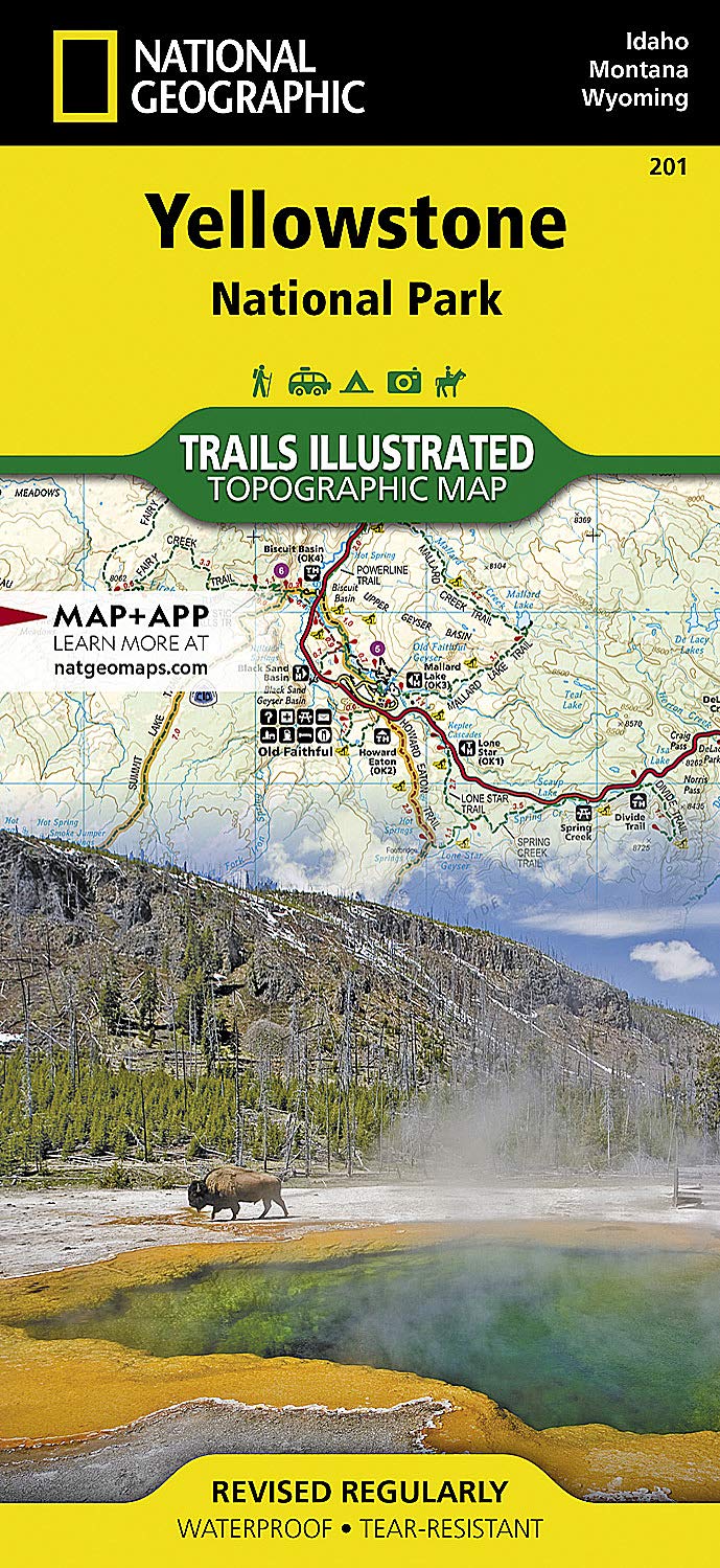
Backcountry Tough
- Waterproof
- Tear-Resistant
- Nearly Indestructible
- Detailed Topography
- GPS Compatible With full UTM Grid
 |
 |
 |
 |
 |
|
|---|---|---|---|---|---|
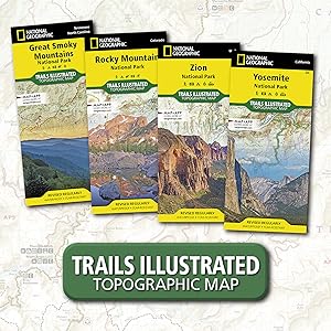
| Great Smoky Mountains National Park | Zion National Park | Rocky Mountain National Park | Yosemite National Park | Yellowstone National Park | |
| Yearly Visitors | 11.3 million | 4.5 million | 4.4 million | 4.3 million | 4.1 million |
| Date Established | 1934 | 1919 | 1915 | 1890 | 1872 |
| Miles of Trails | 820 miles | 88 miles | 431 miles | 782 miles | 1,021 miles |
| State | North Carolina, Tennessee | Utah | Colorado | California | Wyoming, Montana, Idaho |


T3Knical5urg3 –
I have always had good luck with Nat Geo maps having well labeled and marked trails. This map is no exception. I recently planned a backpacking trip in the southern section of Yellowstone so immediately picked this map up to plan the trip. As usual the map is a nice heavy waterproof material that can hold up to the elements and general beating a map takes when on multi-night backpacking trips.The northern and southern section of the map are separated on the front and back of the map allowing for a more detailed view f both sections. All of the trails listed were correct and up to date in all the areas we traveled in the park.As a user of many other brands of maps in the past, I can say this map (and Nat Geo in general) is the best option.
Camren N. –
We loved studying this prior to heading to Yellowstone and then while there this was necessary. Phone service can be in and out, so a map is key. The park will give you one, but it won’t be near as detailed as this one. If you wait to buy it there you will pay more.
NY Steve –
The maps are accurate, detailed and clear.And best of all they are waterproof. They should last well, and I can use them when I’m afraid to bring my GPS with me, since that is not waterproof.This pack of maps encompasses the entire park. Divided into sections they are easy to open, view, and fold back up again without you wondering if you are doing it backwards!Go for it. While in the area, I needed Teton maps too, I picked those up in a gift shop.No maps – no hikes!
keZiah –
I bought lots of yellowstone maps, this one is my favorite. We recommend it!
Gene –
Must have if you are going to travel to Yellowstone.
Peabarter –
Great quality maps for going to the national park areas. Lot’s of detail. I met some other hikers on the trail and we decided to hike together for a while. Their comment when I broke out the map was “Nice map”.
Wally –
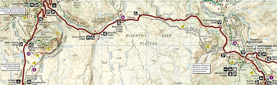
I like to hike in the national parks and use Trails Illustrated maps when they are available. Trail books often have small maps of the trails they describe, and those maps are fine for short hikes, but it’s a good idea to have a larger topographic map for longer hikes. TI maps are durable and have a water resistant coating. (Good for when you get caught in the rain; probably less so if you fall in a creek.) TI maps mark the trails and their topographic features. The elevation markings give you a good idea of how steep a portion of a trail is. I’ve used TI’s Yellowstone map for several trails and always found them to be accurate and helpful.I recently purchased the 2008 revision. Unfolded, the map paper is the same size as the 1998 revision, but feels substantially heavier. The park map, however, is now a bit bigger and is split with the north half of the park on one side and the south on the other (with a generous overlap between the two). The written information about the park that was previously on the back is still present, but is reduced in size and located in several smaller boxes spread around the map. A new feature is that the information on the map does not end abruptly at the park boundary. Thus, for example, if you use the north entrance to the park you can see some additional trails, picnic, camping, and fishing areas marked to the north of the park as you come in on US 89. I don’t use it, but the map now indicates that it is GPS compatible with a full UTM grid.TI’s Yellowstone map is worth having if you plan to do any hikes longer than a few miles. The 2008 is a good buy, particularly if you have an older revision that is showing some wear. If your older revision is in good shape (they are durable after all!) you can probably get by with it.
Dale A Hopkins –
Just received this trailmap today for my trip to Yellowstone coming up. Excellent resource! Has all the trails that the map you receive at the gate does not have. Has a list of short, half-day, full-day trails and their length and how challenging they are. Highly recommend!
alexandra –
Very nice weatherproof map with a ton of details about the national parks! Things the maps given at Yellowstone do not contain!
Marcus Arelius –
Great map! Helped on our trip to Yellowstone immensely! We were able to find the habitats of moose, honey badger, wolverine, vole, bison and albatross! Made vole, badger, albatross and wolverine kabobs for dinner! Delicious.
William –
Item was as described. Fast shipping. Best price.
Peter –
If you plan to visit Yellowstone this map is a must have. Water and tear resistant. Updated in 2019. The trail guide is very helpful with mile markers and topography. Many details not on the park map handed out at the gate will help you find less traveled roads and trails. Been camping at Yellowstone 4 times in the last 10 years and plan to go back in 2022 with this map in my backpack.
Amy R. –
We love the Trails Illustrated series of maps. They’re made of a wonderful waterproof material, resistant to tearing, and therefore perfect for hauling around in the elements on a hike. Topographic detail is super-useful even if you’re not doing big backcountry hiking, good for just exploring the park.I recommend you buy this pack before a trip to Yellowstone. Getting all four maps gives you a break in the price, plus you’ll pay a real premium for individual maps sold at stores in and around the park.
Gumby –
These maps actually list the campsite numbers, which is what I was looking for. The basic map from National Geographic (as good as it is) doesn’t list the actual backcountry campsites, which is worthless for backcountry hiking/backpacking. Get these if you need the backcountry campsites.
Cameragirl –
Quality made foldable map of the park with a nice finish. Ordered it before our trip so we could plan our daytrips before we reached the park and received the park version. Very helpful to plan with.